
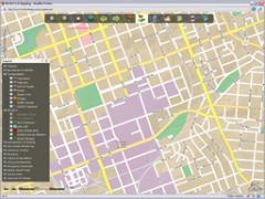
Richland County has just completed the development of a new Internet Mapping Service built using the lastest in ESRI ArcGIS Server technologies. The new service utilizes two cached map services for our cartographic base map and our latest orthophotography (2009) basemap. All other layers are drawn dynamically on top of these cached products, improving user performance and overall usability drastically. Please visit the Mapping page to access the new Internet Mapping Service 2.0.
Start Date:
Wednesday, July 2, 2008 to Friday, July 1, 2011